Table of Contents
Civil Engineering Projects - tunnels etc.
The Channel Tunnel
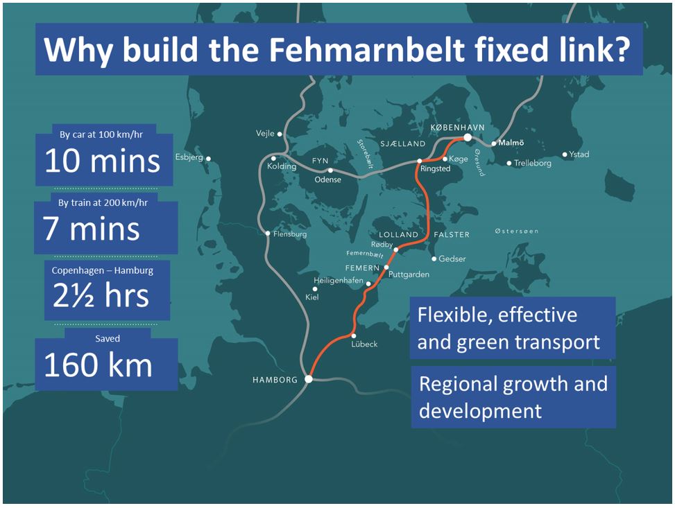
The Fehmarnbelt Fixed-Link
An 18 km long immersed tunnel is under construction between Denmark and Germany (see www.Femern.com) connecting Lolland, Denmark with the German island of Fehmarn. When complete, it will form the fastest route between Scandinavia and central Europe (Fig below).
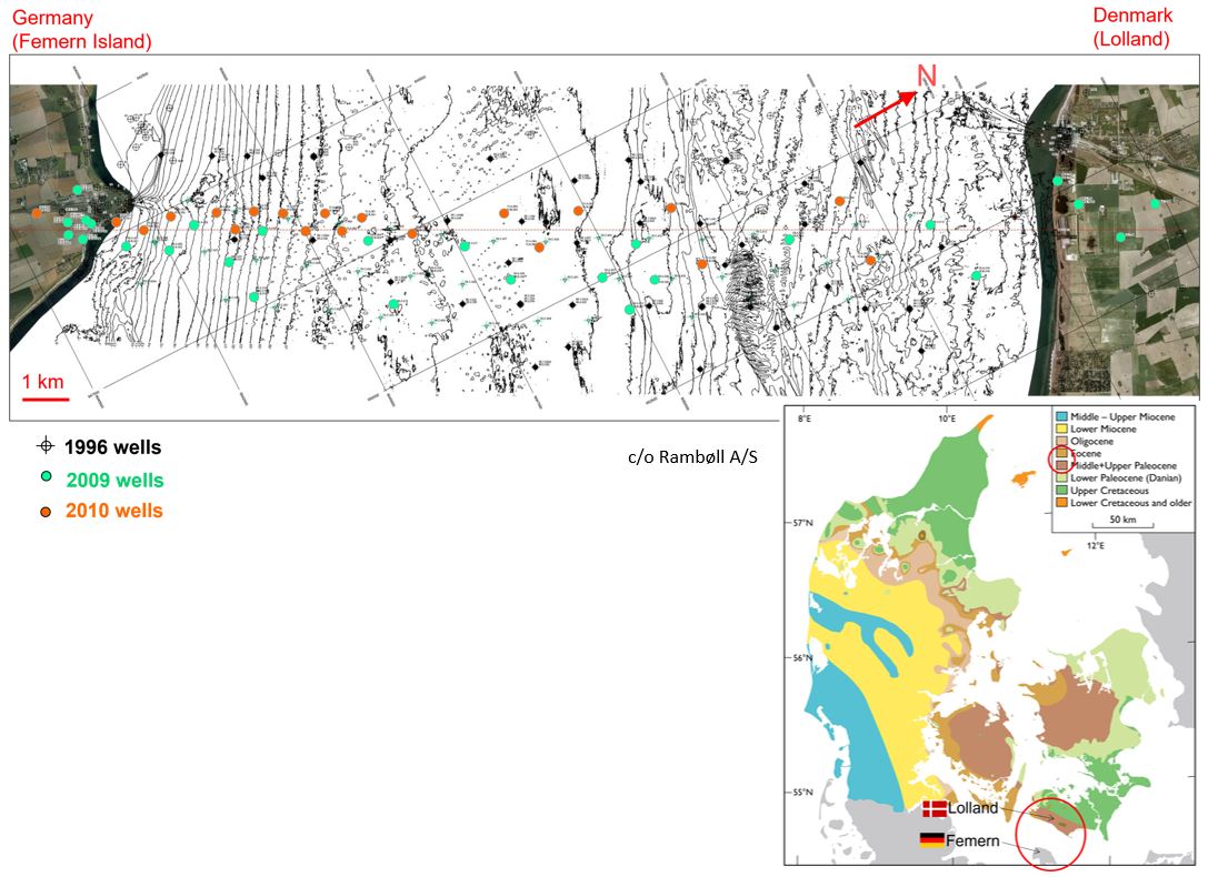
Before deciding to build a bridge, drill a tunnel through rock or construct an immersed tunnel under the sea-bed, a vast amount of research was carried out on the geology of the Fehmarnbelt area. The sub-Quaternary succession on Lolland was fairly well-known due to knowledge obtained from ground water wells and two old exploration boreholes. The area is characterized by folded, thrusted and faulted Paleocene and Eocene ‘plastic’ clays (see geological map) but the geology under the Fehmarnbelt had not been mapped in detail.
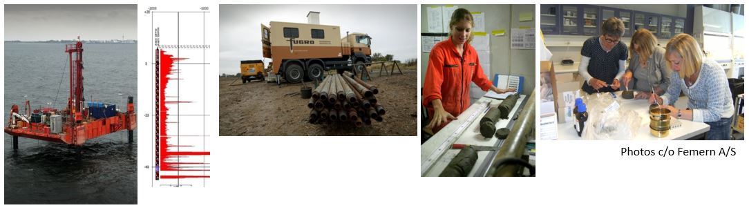
Multiple cored wells were drilled on Lolland, across the Fehmarnbelt and on Fehmarn in 1996, 2009 and 2010 (Fig below) in order to investigate the nature of the geology. Geological and geophysical investigations on the cores included biostratigraphic and rock strength studies (Fig further below).
An extensive biostratigraphic study was carried out using several fossil groups on hundreds of core samples. This multidisciplinary approach was necessary as individual rock formations do not necessarily contain all fossil groups. The Fig below shows a selection of the calcareous nannofossils, microfossils (foraminifera, diatoms) and dinoflagellate cysts that were recovered from the cores.
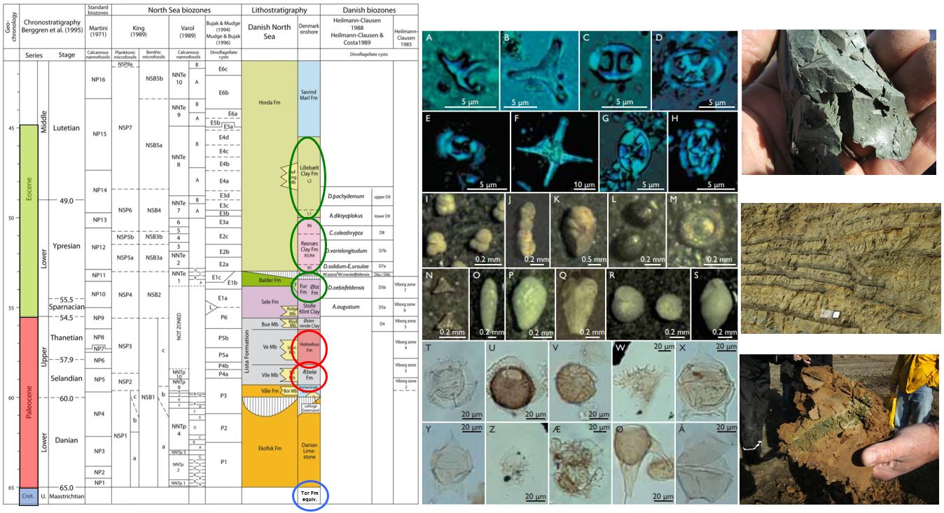
Using biostratigraphic zonation schemes for microfossils, nannofossils and dinoflagellate cysts that were erected for the North Sea area and onshore Denmark (see zonation scheme above), the samples from the Fehmarnbelt cores were dated and assigned to Danish lithostratigraphic units (circled) e.g. the Lillebælt Clay Formation, the Røsnæs Clay Formation and the Fur Formation (pictured above). These lithologies were then correlated across the Fehmarnbelt.
The biostratigraphic study combined with rock strength investigations provided a geological model (fig below) revealing complex deformed Palaeogene clays underlain by chalk which itself was impacted by salt movement below.
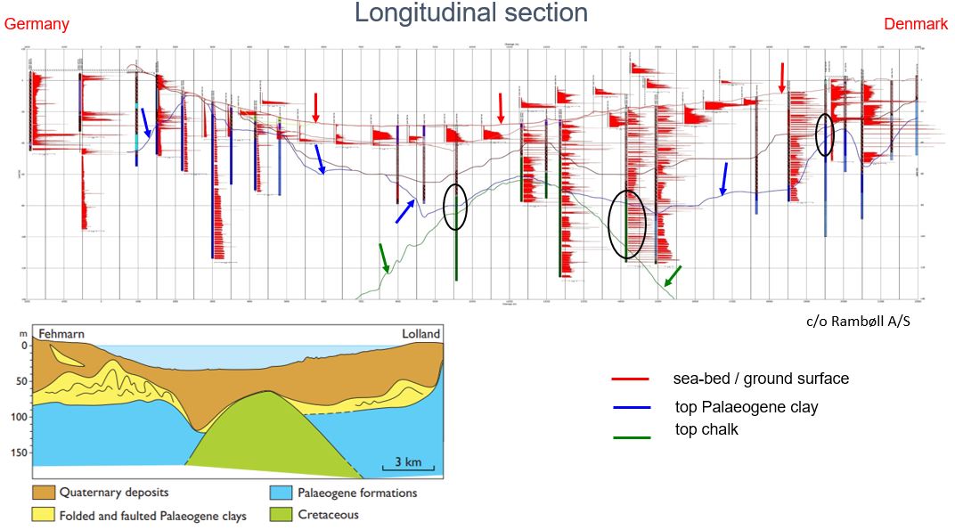
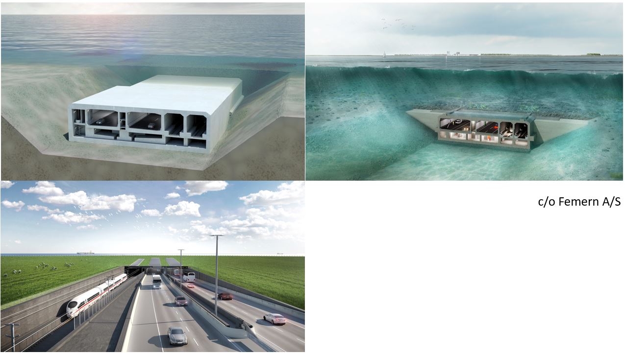
For construction it was important to unravel the folding/thrusting/ deformation problem and to map the depth to the top of the plastic clays. The tunnel / bridge foundations need to be supported by lots of glacial till above the Palaeogene clays. The final decision to construct the world’s longest immersed tunnel (see images below) was taken following lengthy socio-political discussions and thorough environmental research and geological investigations. Concrete tunnel elements will be positioned in a trench dug into the seabed. The road and rail tunnel should be completed by 2029.